From Land Patent to Google Earth
This tutorial shows how to convert from a Land Patent Land Description to map coordinates, then display those coordinates on Google Earth.
If you already have your Land Description, you can skip to the section for Earth Point.
Otherwise go to the Bureau of Land Management (BLM) General Land Office (GLO) Records search page:
http://www.glorecords.blm.gov/search/default.aspx#
Click on the Land Patents link.

Type in Name, and Press <Search Patents> (This example uses Shadrach Bush) Be sure that the State option is set to “——Any State——“. This option appears at the end of the drop down menu for State in the Location box.

Which leads to this Search Result:

Click on the Accession Number link to see the Patent Details.

From the Patent Details, you can view the information about the Land Patent, and the Land Description.
The Land Description details are used to find where the land is in Google Earth.
The description of Shadrach Bush’s land is
- State: Ohio
- Meridian: U. S. Military Survey
- Twp – Rag (Township-Range): 005N – 009W
- Aliquots: E1/2 SE1/4
- Section: 14
- County: Coshocton

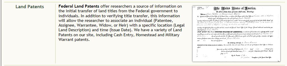
From the Patent Image Tab you can download an image of the Land Patent.

You can and should download the Land Patent document (in pdf format) to your computer. (I was able to right click on the image to save it.)

The Related Documents Tab shows the Patentees in the same Section.

With this information, go to the Earth Point website to turn the description into map coordinates. This part of the website is free. http://www.earthpoint.us

On the left side, in USA Utilities section, in Township & Range, select Search by Description.

Enter the Land Details:
(Select these in order from top to bottom, as each selection displays different options in the drop down menu below it.)
State: Ohio
Principle Meridian: U.S. Military Survey
Township: 005N
Range: 009 W
Section: 14

After entering the data, press view to get the latitude and longitude coordinates (in decimal form) of the Township and the Section.

To see the coordinates on a map:
Select “Fly To On Google Earth” button
NOTE: You must have Google Earth installed to use this button to automatically fly to the location on the map. (If Google Earth is not installed, a .kml file is downloaded)
https://www.google.com/earth/versions
Select “Google Earth Pro on desktop” and follow the installation instructions.
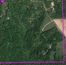
When the map is open, you can use the controls to change the tilt of the map and the zoom into the detail you want to see. If a street view is available, you can position the pegman on the map to look around.
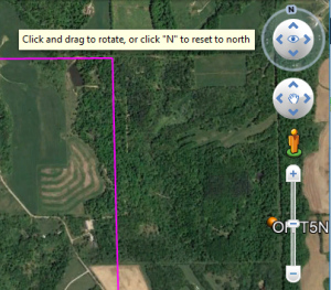
On the map:
The orange square on the map is the entire township
The purple square is Section 14

Where in the section is the property?
Look at the aliquots parts within the section to find which part of the section Shadrach Bush bought.
Start at the end of the description to find the quarter of the section where the property is located.
A quarter of the section is 160 acres. A half of the quarter is 80 acres.
E1/2SE1/4 means the east half of the southeast corner
The property is in the Southeast quarter (SE1/4) of Section 14.
It is the East half (E1/2) of that quarter.
Good luck getting the map of your patent, and let me know how you do.